Caribbean Disaster
Mitigation Project
Implemented by the Organization of American States
Unit of Sustainable Development and Environment
for the USAID Office of Foreign Disaster Assistance and the Caribbean Regional Program


Caribbean Disaster
Mitigation Project |
|
Note: these figures accompany the trip report for the Kingston multi-hazard assessment gravity survey.
Figure 1 – Kingston gravity survey routes. East-west and north-south survey routes are superimposed on a contour map of the minimum thickness of the Liguanea Alluvial Plain. Contour interval: 20 m.
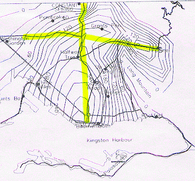
Figure 2 – Marking the Survey route. Stu Nishenko paints a circle around a PK nail that will mark a GPS/gravity station for the Kingston survey.
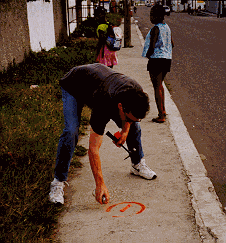
Figure 3 – At the start of the Survey in Papine. Bob Moose (kneeling) takes a gravity measurement with Nagheib Miller looking on. Glendon Newsome, in the background, explains the proceedings to a passerby.
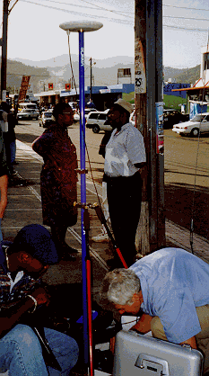
Figure 4 – Surveying in a station. John Marshall with GPS antenna.
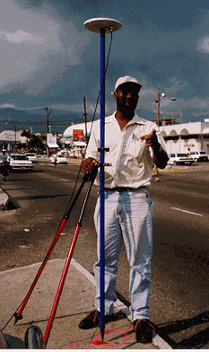
Figure 5 – Close up of Bob Moose with gravity and GPS equipment.
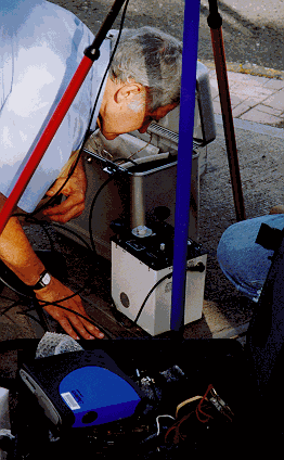
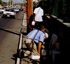
Figure 6 – Bob Moose and Bill McCann taking gravity measurements on Old Hope Road during the morning rush hour.
| CDMP home page: http://www.oas.org/en/cdmp/ | Project Contacts | Page Last Updated: 20 April 2001 |