Caribbean Disaster
Mitigation Project
Implemented by the Organization of American States
Unit of Sustainable Development and Environment
for the USAID Office of Foreign Disaster Assistance and the Caribbean Regional Program


Caribbean Disaster
Mitigation Project |
|
Susceptibility Classes are based on landslide densities in 249 unique combinations of slope, aspect, lithology and distance to faults. Only definite and probable scarps were included in calculating landslide density.
Boundaries between susceptibility classes (low, moderate, high, very high) are somewhat arbitrary, but were chosen to highlight differences in susceptibility to landslideing within mountainous terrain.
This method of mapping landslide susceptibility is termed the Landslide Susceptibility Matrix Approach (see DeGraff and Romesburg, 1980).
The zones on this map reflect variable potential for initiating a landslide on a slope, but do not necessarily indicate how far the landslides will travel, or where the landslide debris (or debris flow) will be deposited. Additional hazards from landslide deposition may exist downslope fromt he high susceptibility regions on this map, or at the mouths of drainage basins with highly susceptible slopes.
These maps were created from digital geographic and geologic data provided by the Department of Geography and Geology, University of the West Indies, Mona Campus, Jamaica.
Other available maps: Landslide Susceptibility
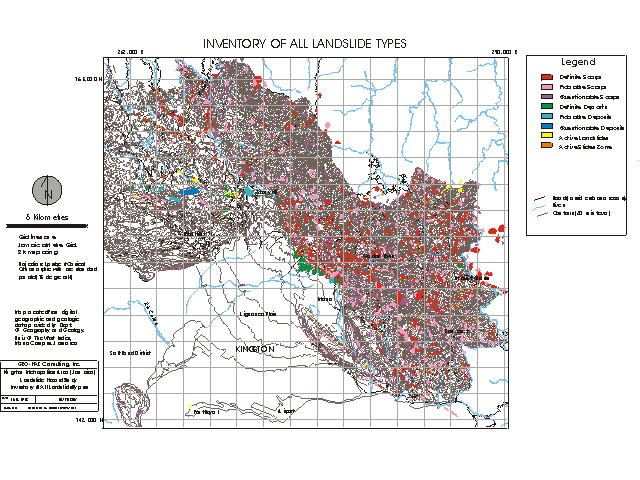
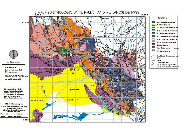
These maps were produced as part of the landslide hazard assessment component of the multi-hazard assessment for the Kingston Jamaica metropolitan area, which is funded by the OAS/USAID Caribbean Disaster Mitigation Project.
| CDMP home page: http://www.oas.org/en/cdmp/ | Project Contacts | Page Last Updated: 20 April 2001 |